
In 2025, I began a project to circumnavigate all of the major Gulf Islands and Discovery Islands by kayak. This is a personal project that I work on as time and conditions allow.
Below is what I’ve completed to date. Click the drop-down arrow to the left of each Island to view trip details and photos.
Project status: 8 of 40 islands complete (20%), for a total paddling distance of 186.27 nautical miles (344.97 kilometres).
Southern Gulf Islands
Gabriola Island – Circumnavigated January 27, 2025
- Island Size: 57.6 square kilometres
- Date Circumnavigated: January 27, 2025
- Direction of Circumnavigation: Counterclockwise
- Route Summary: Counterclockwise circumnavigation launching and landing at the public boat launch at the end of Gray Road in Degnen Bay on Gabriola Island. Passed east through Gabriola Passage with a flood current of about +1.5 knots. Passed south through False Narrows with an ebb current of about -3 knots.
- Total Paddling Distance: 20.82 nautical miles (38.5 kilometres)
- Total Paddling Time: 5 hours, 42 minutes
- Total Trip Time (Including Breaks): 6 hours, 30 minutes
- Moving Average Speed: 3.6 knots
- Overall Average Speed: 3.2 knots
- Maximum Speed: 6.7 knots
- Boat: Northshore Atlantic LV Rotomold
- Highlights: Timing and navigating two current stations (Gabriola Passage and False Narrows); seeing the outside shore of Gabriola for the first time; watching Steller sea lions circle below my boat near near Orlebar Point; the sandstone cliffs on Gabriola’s southwestern shore shining golden in the afternoon light; cruising down False Narrows with an ebb current of almost 3 knots at my back near the end of the day; calm waters and sunny skies — a perfect day to tick this one off my bucket list!

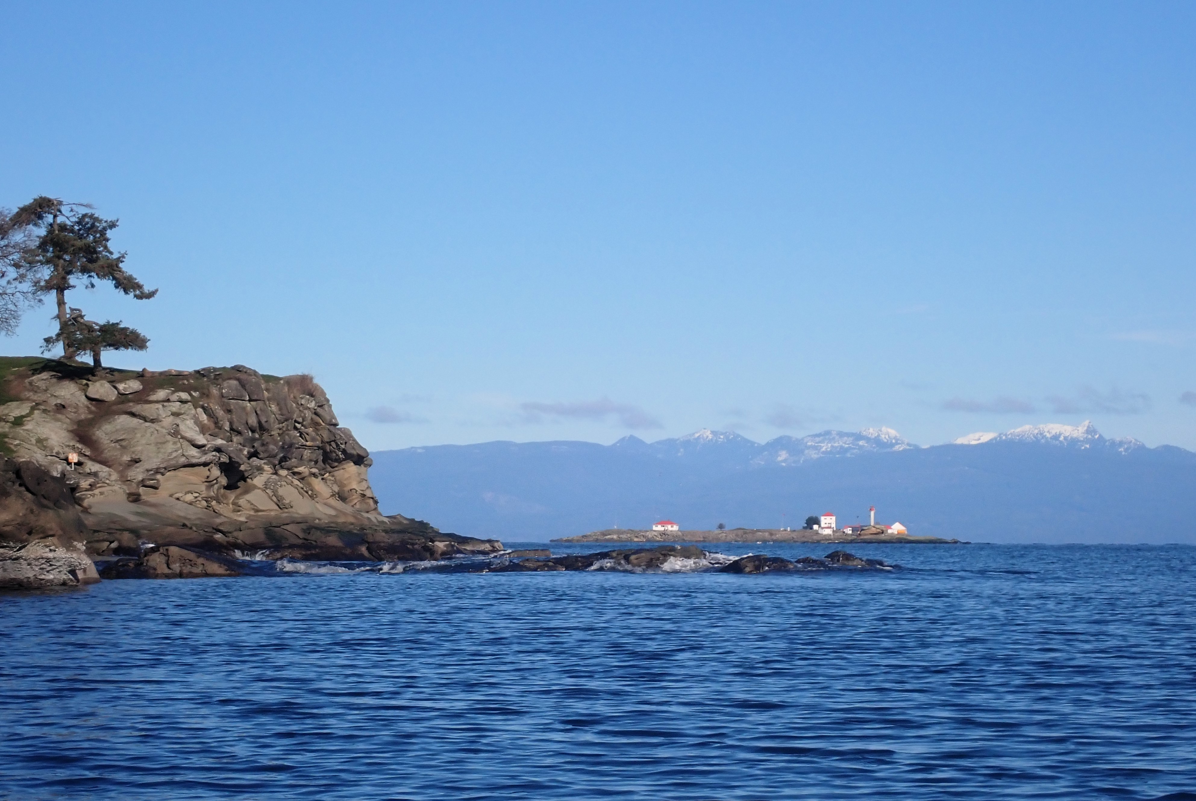
Approaching Silva Bay after passing through Gabriola Passage. Entrance Island Light Station in view after leaving Sandwell Provincial Park and Lock Bay. 
En route! 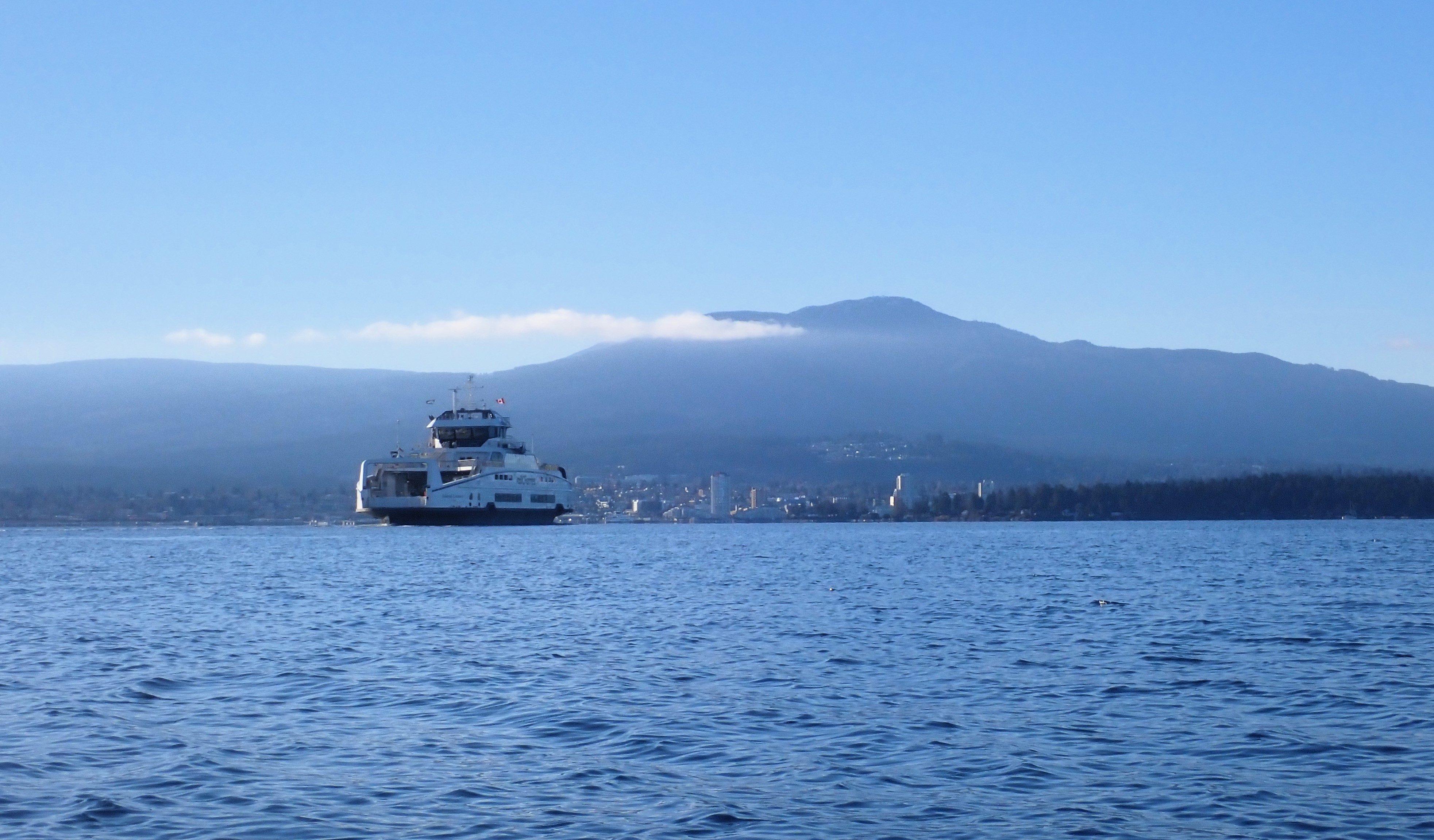
BC Ferry from Gabriola Island to Nanaimo near Descanso Bay. 
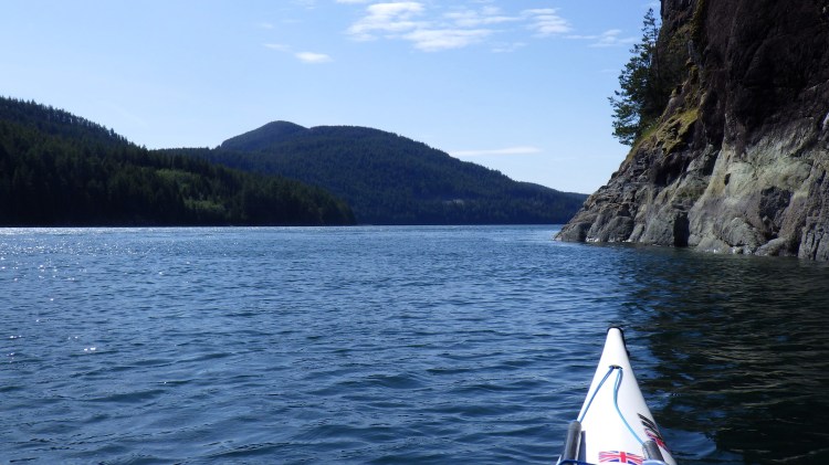
Gorgeous sandstone cliffs south of Descanso Bay. 
More beautiful sandstone cliffs. 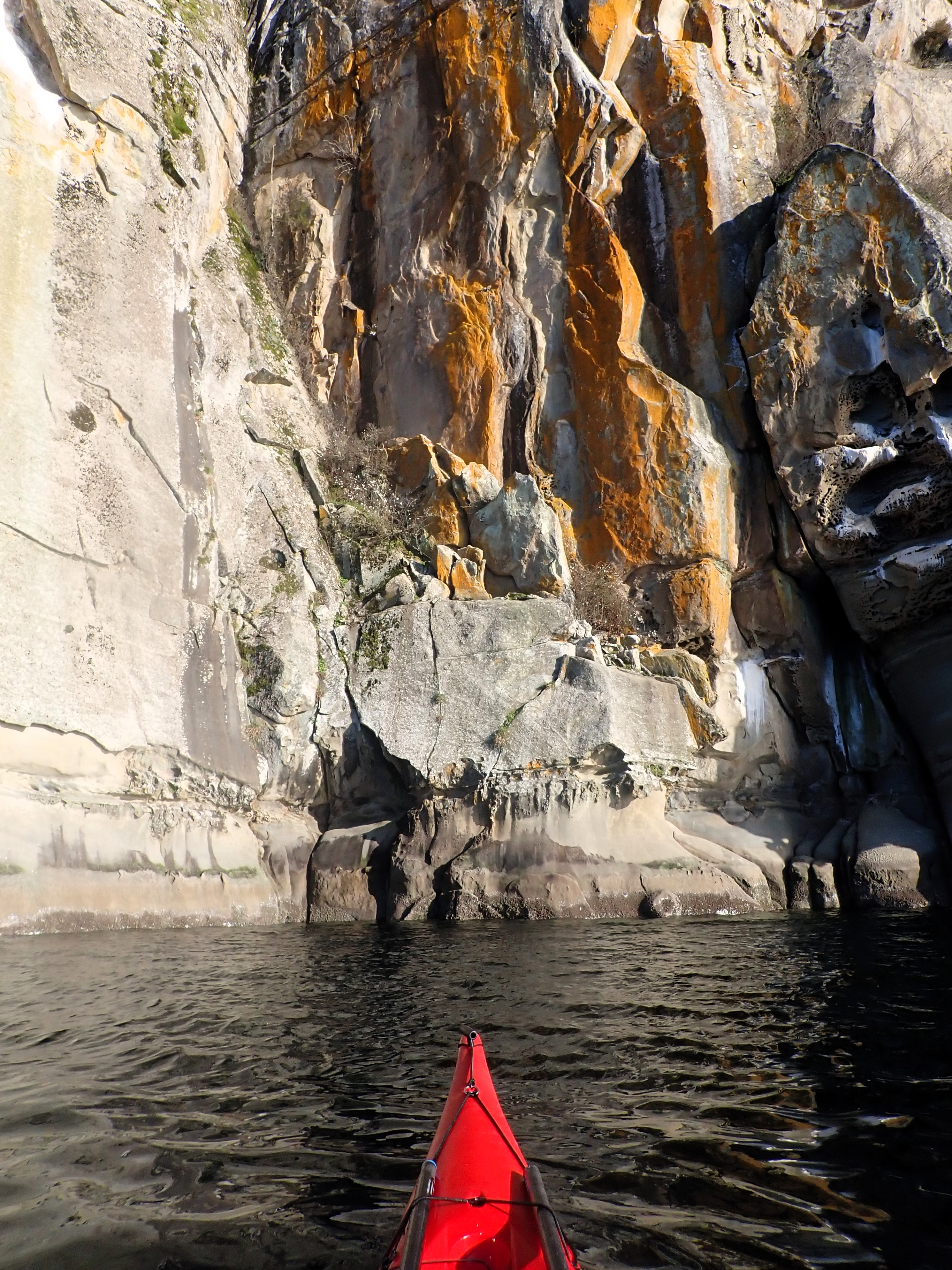
Interesting colours. 
A long stretch of log booms in Northumberland Channel. 
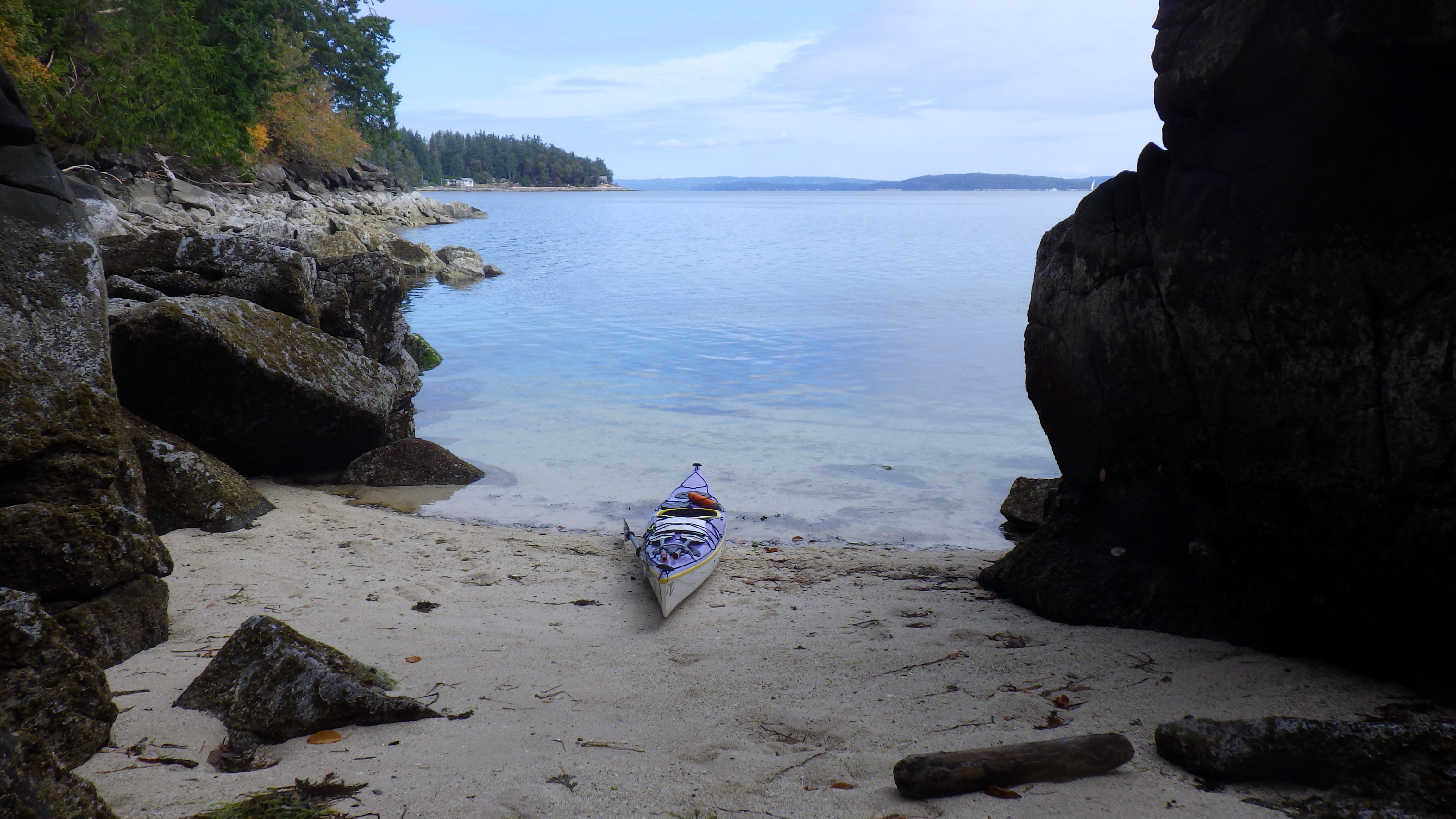
Mount Baker in view as I enter Degnen Bay in the afternoon.
Thetis Island – Circumnavigated July 20, 2025
- Island Size: 10.36 square kilometres
- Date Circumnavigated: July 20, 2025
- Direction of Circumnavigation: Clockwise
- Route Summary: Launched at Blue Heron Community Park just north of Yellow Point. Crossed to Pilkey Point on the northeast tip of Thetis Island via Miami Islet and the Ragged Islets. Completed a clockwise circumnavigation of Thetis starting and ending at Pilkey Point. Returned to Blue Heron Park via the same route (Ragged Islets and Miami Islet).
- Total Paddling Distance: 15.87 nm (29.4 kilometres) for the full trip; 9.37 nautical miles (17.4 kilometres) for the Thetis Island circumnavigation only.
- Total Paddling Time: 4 hours 29 minutes for the full trip; 2 hours 42 minutes for the Thetis Island circumnavigation only.
- Total Trip Time (Including Breaks): 4 hours 54 minutes for the full trip; 2 hours 57 minutes for the Thetis Island circumnavigation only.
- Moving Average Speed: 3.5 knots for both the full trip and the Thetis Island circumnavigation.
- Overall Average Speed: 3.2 knots for both the full trip and the Thetis Island circumnavigation.
- Maximum Speed: 5.4 knots for the full trip; 4.9 knots for the Thetis Island circumnavigation only.
- Boat: P&H Aries 150
- Highlights: Checking out the buoy marking the shipwreck at Miami Islet (the last time I was here thick fog rolled in and I was focussed on transitioning to navigating by compass); seeing a seal mother nursing her pup on the rocks (they were not spooked by me); cruising through The Cut between Thetis and Penelakut Islands with just enough tide height and the flood current pushing me along; navigating pleasure craft traffic on the crossing back to Blue Heron (not my favourite activity, to be sure)!

Launching at a low tide at Blue Heron Park. My kayak is a speck at the water line! 
Red nun buoy marking safe passage around the rocks and reefs north of Thetis Island. 
Batman’s Island? Nope, just a cormorant drying its wings on the navigation marker on the Ragged Islets. 
Beautiful pocket beach for a break on the east side of Thetis Island. 
Entering The Cut from Clam Bay: shallow water, sandbars and day markers to guide the way. 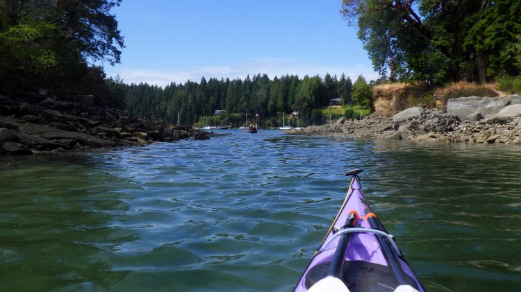
Following a row boat through The Cut between Thetis and Penelakut Islands, with just enough water to paddle through. 
Approaching Telegraph Harbour Marina on the west side of The Cut. 
Hudson Island straight ahead as I round Foster Point at right towards Preedy Harbour. 
Intertidal northern tip of Hudson Island, where I stopped for a quick break. 
Break stop on the Ragged Islets on my way back to Blue Heron Park. 
Purple shells pop next to my purple kayak.
Valdes Island – Circumnavigated January 19, 2026
- Island Size: 23 square kilometres
- Date Circumnavigated: January 19, 2026
- Direction of Circumnavigation: Counterclockwise
- Route Summary: Launched from Degnen Bay on Gabriola Island. Ferried across Gabriola Passage on an ebb current of about -4 knots; then started my circumnavigation at the west tip of Cordero Point, at the mouth of Wakes Cove. Transited Porlier Pass on a flood current of about +3 knots. Transited Gabriola Passage back to my starting point on a flood current of about +1.5 knots.
- Total Paddling Distance: 20.23 nm (37.5 kilometres) for the full trip; 18.48 nautical miles (34.2 kilometres) for the circumnavigation only.
- Total Paddling Time: 5 hours 23 minutes for the full trip; 4 hours 54 minutes for the circumnavigation only.
- Stopped Time: 37 minutes 32 seconds for the full trip; 32 minutes 8 seconds for the circumnavigation only.
- Total Trip Time (Including Breaks): 6 hours for the full trip; 5 hours 26 minutes for the circumnavigation only.
- Moving Average Speed: 3.7 knots for the full trip; 3.8 knots for the circumnavigation only.
- Overall Average Speed: 3.4 knots for both the full trip and the circumnavigation.
- Maximum Speed: 5.6 knots for the full trip (recorded while ferrying across Gabriola Passage on the ebb current).
- Boat: P&H Aries 150
- Highlights: Completing most of this trip in thick fog, such that I couldn’t really see Porlier Pass, or the eastern shoreline of Valdes Island. (Guess I’ll have to go again!) 🌫 Using my compass to navigate the short distance to Gabriola Island upon launching. 🌫 Sunny, blue-sky break stop at Blackberry Point during a moment the fog lifted. 🌫 Calm winds, low tide ranges and helpful, no-pressure current speeds. 🌫 Watching a group of Steller sea lions swimming and breaching by me through the glassy waters. 🌫 Hearing the wingbeats of sea birds in the quiet of the fog, and watching large flocks of sea birds wing by, low to the water, or take off across the water in a flurry of splashes. 🌫 Completing this trip in less time that I thought it would take me. 🌫 Finally ticking this one off my list — it has been almost a year in the making!
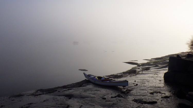
Launching in thick fog on Gabriola Island. 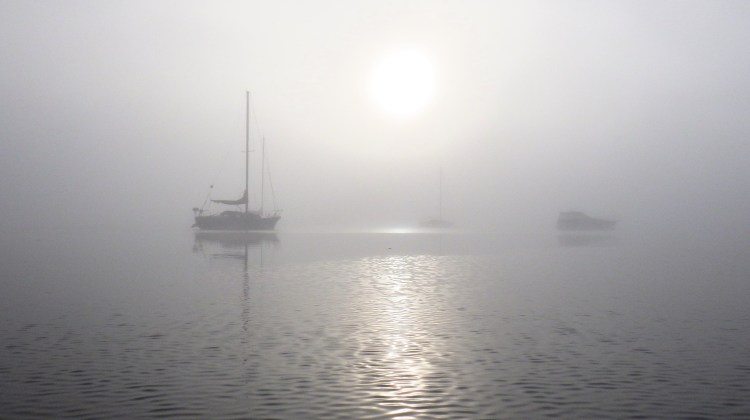
Navigating to Valdes through a maze of “ghost ships.” 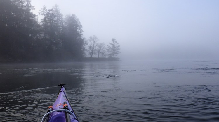
Beginning my circuit of the Valdes shoreline, in Gabriola Passage. 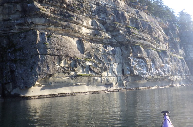
The only Valdes sandstone cliff that revealed itself during a break in the fog. 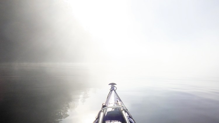
Stunning view! 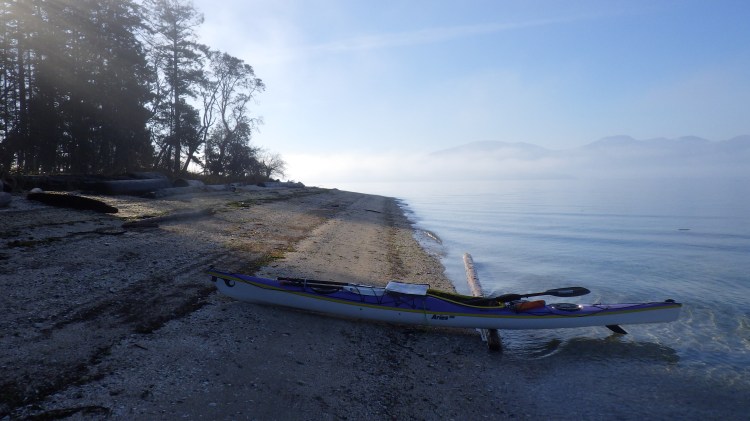
Sunny break stop during a momentary and welcome break in the fog. 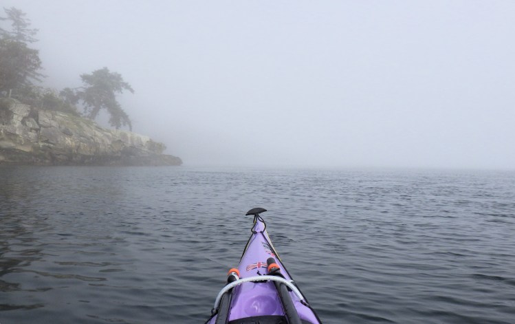
Entering Porlier Pass, a current station at the south tip of Valdes. 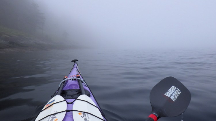
The outside shore of Valdes was like this the whole way. 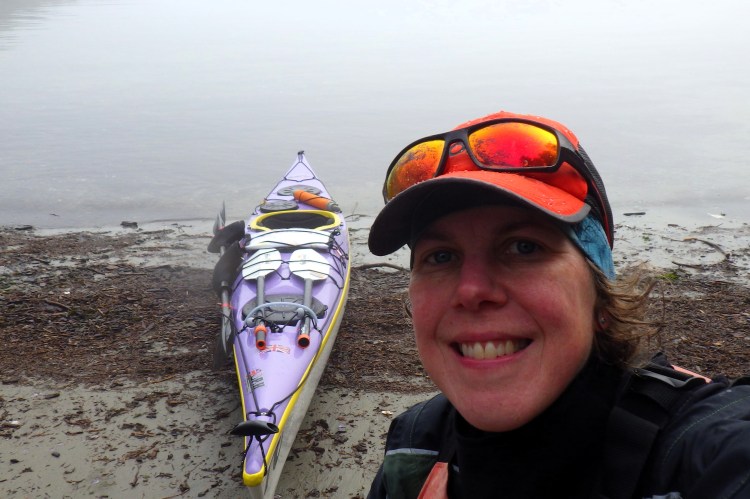
Break stop at Shah Point. 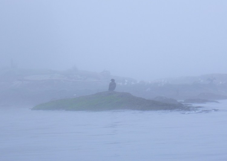
Juvenile eagle on sentry duty. 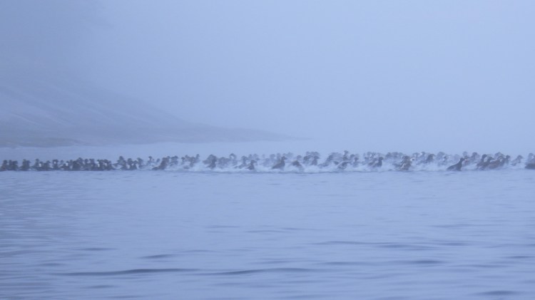
Sea birds take off in a chaotic flurry. 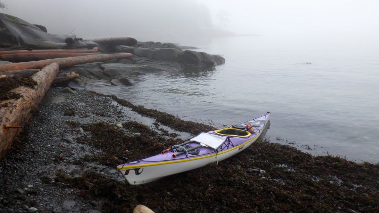
Last break stop on the eastern shore of Valdes. 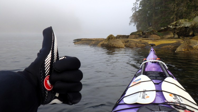
Back in Gabriola Passage. Circumnavigation complete! 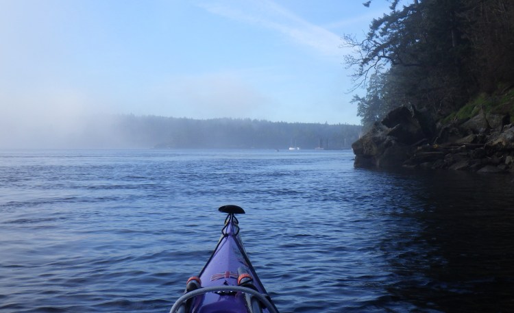
The fog began to lift as I returned to my launch site.
Northern Gulf Islands
Hardy Island – Circumnavigated August 8, 2025
- Island Size: 7.25 square kilometres
- Date Circumnavigated: August 8, 2025
- Direction of Circumnavigation: Clockwise
- Route Summary: I completed this circumnavigation as part of a larger three-day trip around Nelson Island. I started and ended the circumnavigation at a point on the east end of Hardy Island, just inside Telescope Passage. I handrailed the shoreline clockwise from here, stopping for lunch at the BC Marine Trails picnic spot “Blind Bay North” and checking out the very rocky Hardy Island Marine Park en route (too rocky to land or camp at for me as a solo paddler). I continued around the west and north shores of Hardy, stopping at some pretty little islets on the north side for a quick break before returning to my starting point to complete the circumnavigation.
- Tide & Weather Observations: Tides were flooding with a large 4.0-metre range during the circumnavigation. I chose a clockwise route to have the building flood tides (and inflow winds) with me as I paddled east up Jervis Inlet, along the north shore of Hardy Island. I did not notice the flood tide significantly with (or against) me at any point, even though I was supposedly paddling up Jervis during the midpoint of the flood cycle. From observations, especially of wind against current, it seems the main tidal flow happens a bit farther out in Jervis Inlet, while the waters around Hardy are less affected.
- Total Paddling Distance: 9.16 nm (16.9 kilometres)
- Total Paddling Time: 2 hours 43 minutes
- Total Trip Time (Including Breaks): 3 hours 17 minutes
- Moving Average Speed: 3.4 knots
- Overall Average Speed: 2.8 knots
- Maximum Speed: Unknown
- Boat: Wilderness Systems Tempest 170 Pro
- Highlights: Deciding to do this circumnavigation as part of a larger day that included another 16+ nautical miles of paddling, and enjoying it! 🌄 Seeing a bizarre abandoned home construction project near Hardy Island Marine Park; it looked like someone was building a castle but ran out of money. 🌄 Seeing orcas spouting in the distance as I left Blind Bay to round the west side of Hardy Island. 🌄 Break stop in some pretty islets on the north shore. 🌄 Smooth sailing along the west and north shores when I was expecting windier conditions.
View southwest down Blind Bay from Telescope Passage as I started my circumnavigation. Hardy Island is at right; Nelson Island at left. 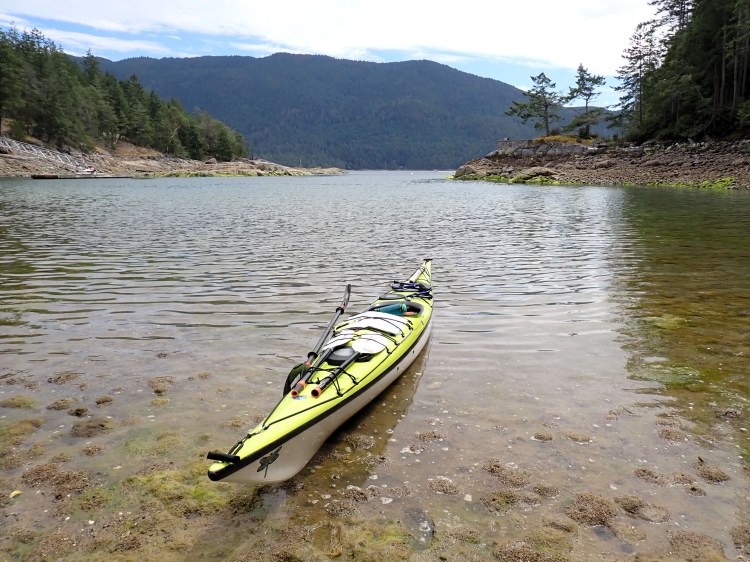
Lunch stop in the intertidal mud of the Blind Bay North picnic site. 
Ready to re-launch after lunch. 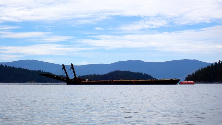
Moored barge in Blind Bay approaching Hardy Island Marine Park. 
Abandoned construction project on a prominent point near Hardy Island Marine Park. 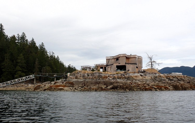
Someone was there either salvaging or other. 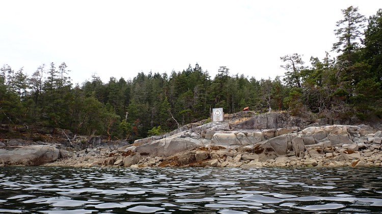
Part of Hardy Island Marine Park. Rocky shoreline at all tide heights! The park includes tiny Musket Islet off Hardy and the park was formerly called Musket Island Marine Park, hence the name on the sign. 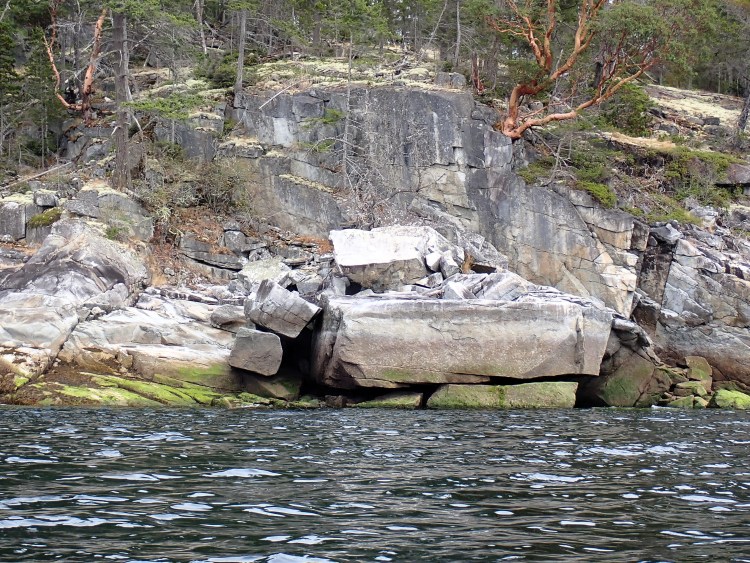
Blocky boulders on the west shore of Hardy Island. 
There are some nicely situated homes on the sparsely populated west and north shores. The Saltery Bay area is visible on the distant Sunshine Coast shoreline. 
Rounding the northwest end of Hardy Island, with first views up Jervis Inlet. 
Break stop on some pretty islets on Hardy’s north shoreline. 
Back where I started in Telescope Passage! You can buy ice cream at the dock on the far shore.
Nelson Island – Circumnavigated August 7-9, 2025
- Island Size: 102.8 square kilometres
- Date Circumnavigated: August 7-9, 2025
- Direction of Circumnavigation: Counterclockwise
- Route Summary: I launched at Madeira Park Dock in Pender Harbour, then paddled over to Fearney Point at the souteast tip of Nelson Island to begin my circumnavigation. On Day 1, I paddled north up Agamemnon Channel with the flood tide, then left Nelson to stay the night in Egmont in Skookumchuck Narrows. On Day 2, I paddled back over to Nelson and continued handrailing the shoreline to the Cockburn Roberts Homesite campsite on the southwest shores of the island. On Day 2, I also detoured from the Neslon circumnavigation to circumnavigate neighbouring Hardy Island. On Day 3, I paddled from Cockburn Roberts Homesite back to Fearney Pont to complete my circumnavigation, then hopscotched back over to Madeira Park via the islands in the outer part of Pender Harbour.
- Tide & Weather Observations: Tide ranges were quite large during paddling hours (3.5-4.0 metres), with the lowest tide of each day between 11:00 a.m. and 12:30 p.m. I chose a counterclockwise direction to make best use of the big flood tide on Day 1, to help carry me north through Agamemnon Channel. From there it was relatively easy to time my paddling to make best use of either the morning ebb or afternoon flood. I did not really feel the tides against me until I rounded Cape Cockburn at the southwest tip of Nelson Island late in the afternoon on Day 2. When the opposing flood hit me there, it felt like I was paddling up a conveyer belt! Thankfully I had only a short distance to cover to my evening camp. Weather was hot, with daytime temperatures in the 30s. After Day 1, I opted not to wear my drysuit, as the risks of overheating were higher than the risks of capsizing.
- Total Paddling Distance:
- 29.74 nm (55.08 kilometres) for the Nelson Island circumnavigation only.
- 53.96 nm (99.93 kilometres) for the entire trip, including paddling to/from Madeira Park, paddling to/from lodging in Egmont on Day 1, and completing the Hardy Island circumnavigation.
- 44.80 nm (82.97 kilometres) for the Nelson Island trip minus the Hardy Island circumnavigation.
- By day:
- Day 1 – 18.93 nm (35.06 km)
- Day 2 – 25.45 nm (47.13 km)
- Day 3 – 9.58 nm (17.74 km)
- Total Paddling Time:
- 8 hours 56 minutes for the Nelson Island circumnavigation only.
- 16 hours 51 minutes for the entire trip, including paddling to/from Madeira Park, paddling to/from lodging in Egmont on Day 1, and completing the Hardy Island circumnavigation.
- 14 hours 8 minutes for the Nelson Island trip minus the Hardy Island circumnavigation.
- By day:
- Day 1 – 6 hours 31 minutes
- Day 2 – 7 hours 28 minutes
- Day 3 – 2 hours 52 minutes
- Total Transit Time (Including Breaks):
- 10 hours 3 minutes for the Nelson Island circumnavigation only.
- 19 hours 19 minutes for the entire trip, including paddling to/from Madeira Park, paddling to/from lodging in Egmont on Day 1, and completing the Hardy Island circumnavigation.
- 16 hours 2 minutes for the Nelson Island trip minus the Hardy Island circumnavigation.
- By day:
- Day 1 – 7 hours 48 minutes
- Day 2 – 8 hours 35 minutes
- Day 3 – 2 hours 56 minutes
- Moving Average Speed:
- 3.3 knots for the Nelson Island circumnavigation only.
- 3.2 knots for the entire trip, including paddling to/from Madeira Park, paddling to/from lodging in Egmont on Day 1, and completing the Hardy Island circumnavigation.
- 3.2 knots for the Nelson Island trip minus the Hardy Island circumnavigation.
- By day:
- Day 1 – 2.9 knots
- Day 2 – 3.4 knots
- Day 3 – 3.3 knots
- Overall Average Speed:
- 3.0 knots for the Nelson Island circumnavigation only.
- 2.8 knots for the entire trip, including paddling to/from Madeira Park, paddling to/from lodging in Egmont on Day 1, and completing the Hardy Island circumnavigation.
- 2.8 knots for the Nelson Island trip minus the Hardy Island circumnavigation.
- By day:
- Day 1 – 2.4 knots
- Day 2 – 3.0 knots
- Day 3 – 3.3 knots
- Maximum Speed: 6.1 knots at the beginning of Day 2, paddling out of Skookumchuck Narrows with the ebb current behind me.
- Boat: Wilderness Systems Tempest 170 Pro
- Highlights: Completing my longest day on the water to date — 25.45 nautical miles in 7.5 hours on Day 2 — and still having gas in the tank for more. 🌞 Paddling off a 1:80,000 scale chart (not something I do often!) 🌞 Paddling two days without my drysuit on due to the heat — so much more comfortable! 🌞 Last-minute search for safe accommodations in Egmont on Day 1 (much floating on the water sorting things out). 🌞 Having beautiful, glassy Agnew Passage all to myself on the morning of Day 2. 🌞 Fitting the Hardy Island circumnavigation in to this trip. 🌞 Ice cream signs on the shore in Telescope Passage. 🌞The west side of Nelson Island from Blind Bay to Cape Cockburn late on Day 2 – calm waters and beautiful scenery. 🌞 Full moon making my tent glow like bioluminescence on Night 2, plus listening to a seals active overnight and hearing a whale pass through in the early morning. 🌞 Paddling around Quarry Bay and on to Fearney Point on the south shore — unique and different landscape! 🌞 The steep rocky cliffs at Fearney Point in Agamemnon Channel. 🌞 Doing this trip solo in totally unknown waters. 🌞 Completing this circumnavigation in three days, then realizing I could have done it in two days!

Ready to launch from Madeira Park Dock on Day 1. 
Paddling out of Pender Harbour. 
Stunning rock cliffs at Fearney Point, inside Agamemnon Channel. 
Glassy Agamemnon Channel about two-thirds of the way to Agnew Passage. 
Looking south down Agamemnon Channel from a break stop across from Earl’s Cove. 
Light at Nile Point, where I stopped my circumnavigation portion of Day 1. 
Paddling to Egmont Point in search of a campsite, with Captain Island on the left. 
Where I ended up staying on night 1 — in lodging in Egmont because the beach campsite was not feasible. 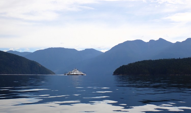
Ferry entering Agnew Passage on Day 2. 
Happy on the water, midway between Agnew Passage and Vanguard Bay. 
Ice cream sign on the shore at Telescope Passage as I entered Blind Bay. The ice cream was for sale on nearby Hardy Island. 
Rounding Cape Cockburn at the southwest end of Nelson Island. 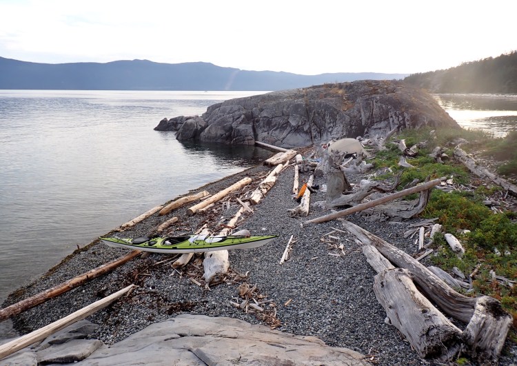
My Day 2 camp at Cockburn Roberts Homesite. 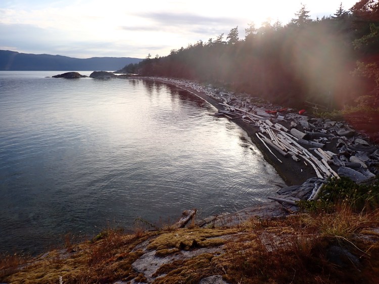
The main beach at Cockburn Roberts Homesite. 
Impressive property in rocky Quarry Bay. 
Circumnavigation complete! Heading back to Madeira Park via the Hodgson Islands. 
Re-entering the Pender Harbour area. 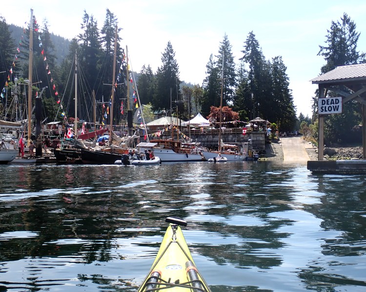
Landing back at Madeira Park, in the middle of the Wooden Boat Festival!
Discovery Islands
Marina Island – Circumnavigated February 7, 2026
- Island Size: NA
- Date Circumnavigated: February 7, 2026
- Circumnavigation Direction: Counterclockwise
- Route Summary: Launched at Gorge Harbour Public Wharf on Cortes Island around 11:00 a.m. Paddled out of Gorge Harbour then northwest along the Cortes shoreline until I reached Shark Spit at the north end of Marina Island. I started and ended my circumnavigation here, then returned to my launch via the same route I paddled out.
- Total Distance: 12.21 nautical miles (22.6 kilometres) (full trip) / 8.19 nautical miles (15.2 kilometres) (circumnavigation only)
- Moving (Paddling) Time: 4 hours 5 minutes (full trip) / 2 hours 51 minutes (circumnavigation only)
- Stopped Time: 20 minutes (full trip) / 2 minutes (circumnavigation only)
- Total Time (Including Breaks): 4 hours 25 minutes (full trip) / 2 hours 53 minutes (circumnavigation only)
- Moving Average Speed: 3.0 knots (full trip) / 2.9 knots (circumnavigation only)
- Overall Average Speed: 2.8 knots (full trip) / 2.8 knots (circumnavigation only)
- Maximum Speed: 5.6 knots
- Boat: P&H Aries 150
- Highlights: (Can we call them that for this one? 😬…) Doing this trip despite high wind forecasts. I thought I would have more protection from the wind than I did. Winds were blowing southeast 13-14 knots gusting into the high 20s in exposed areas. I experienced most of this as a headwind, hence my significantly slower average speed. 🌊 Navigating big seas on the west and southwest shores of Marina Island, with swells over 1 metre. I felt like I was just crawling along. 🌊 Navigating the long intertidal reef at the south tip of Marina Island. Thankfully I hit it at a middling tide height (as per my plan) and was able to find a route through the breaking waves and exposed rocks. 🌊 Having my helmet with me to put on before navigating the reef. I had brought it along just in case — excellent forethought! 🌊 Actively “reducing lemons” as I navigated the challenging sections. I don’t think I have had to consciously and consistently do this in the face of such real consequences on any previous solo paddle. 🌊 Learning more about my own personal limits. This was a challenging trip, and while it was very much in my comfort zone skill-wise, I learned that it was not in my comfort zone as a solo paddler. 🌊 Heavy rain pelting down along the northwest shore of Marina, in calm seas before I hit the messy stuff.
Maurelle Island – Circumnavigated June 4-5, 2025
- Island Size: 54 square kilometres
- Date Circumnavigated: June 4-5, 2025
- Circumnavigation Direction: Clockwise
- Route Summary: Launched at Hoskyn Channel Landing on Quadra Island at 3:30 p.m. on June 4. Paddled to Peck Island, across the south end of Beazley Passage, up between Sturt and Goepel Islands, over to Maurelle Island and to Antonio Point (the start/end point for my circumnavigation). Beazley Passage was ebbing north at about 4 knots when I transited the area. Paddled 7 nautical miles north to Franscisco Island and camped there for the night. On June 5, launched at 8:00 a.m. and paddled through Hole in the Wall with a 3 knot flood current pushing me northeast. Continued around Maurelle and back to Antonio Point. I was ahead of schedule and had some time to play in the flood currents in the Settlers Group at speeds around 3-4 knots before returning to Hoskyn Channel Landing via the same route I took out.
- Total Paddling Distance: 22.36 nautical miles (41.4 kilometres)
- Total Paddling Time: 6 hours 39 minutes
- Total Trip Time (Including Breaks): 21 hours 40 minutes
- Moving Average Speed: 3.4 knots
- Overall Average Speed: 2.9 knots
- Maximum Speed: 7.4 knots
- Boat: P&H Cetus LV
- Highlights: Wind, wind and more wind! A headwind getting to Franscisco Island on June 4 and a tailwind/beam wind along the entire east shore on June 5. 🌞 Watching the currents swirl and the sun set from my beautiful solo camping perch on Franscisco Island. 🌞 Hauling my boat up high enough on the rocks to avoid the high tide at night. 🌞 Paddling through Hole in the Wall for the first time. 🌞 Seeing intertidal walls full of clams and snails on the Maurelle shoreline at the east end of Hole in the Wall. 🌞 Playing in the currents after arriving back in the Settlers Group earlier than expected. 🌞 Ticking this long-standing paddling goal off my list!
Rounding Antonio Point to start my circumnavigation. 
Elephant Island on the west side of Maurelle. 
View from my campsite on Franscisco Island. 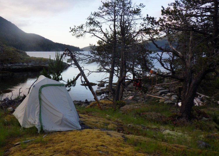
Peaceful and beautiful campsite. 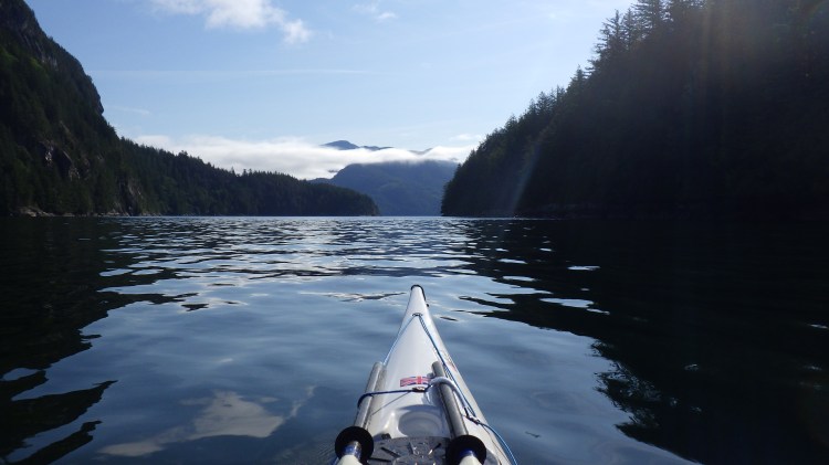
Paddling through Hole in the Wall — out of the wind!! 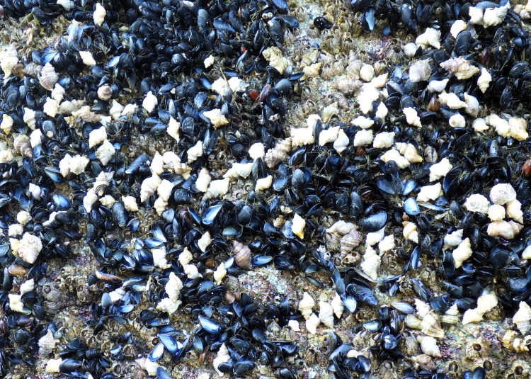
Mussels and snails on an intertidal rock wall at the east end of Hole in the Wall. 
I saw a few sea cucumbers. 
Break stop on the eastern shore of Maurelle. 
View across Calm Channel to Raza Passage and the tip of the Rendezvous Islands. 
Approaching White Rock Passage. 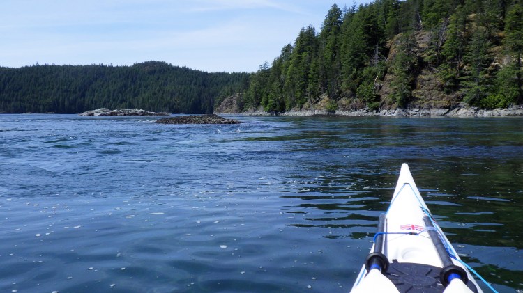
Mild but fun current to play in north of the Settlers Group en route back to Antonio Point. 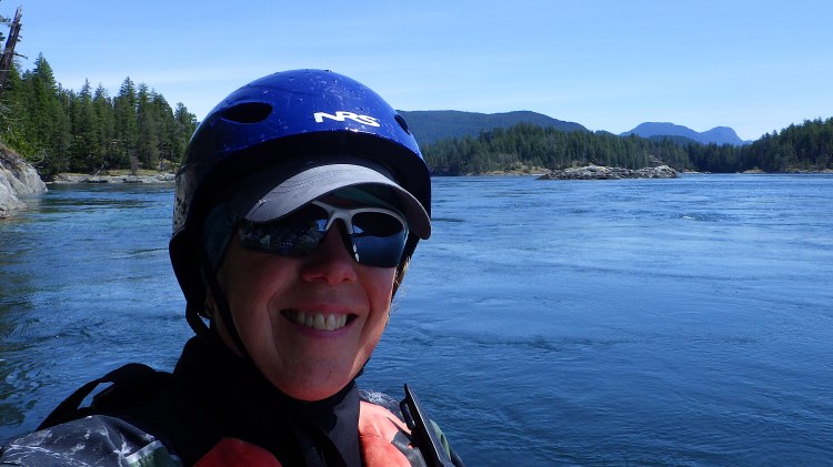
I’m always happy to be in some currents! 
Salty dry suit at the end of the trip.
Read Island – Circumnavigated October 6-7, 2025
- Island Size: 40 square kilometres
- Date Circumnavigated: October 6-7, 2025
- Circumnavigation Direction: Counterclockwise
- Route Summary: Started and ended at Freedom Point (BC Marine Trails site) on Read Island. (Accessed Freedom Point from Discovery Islands Lodge / Hoskyn Channel Landing on Quadra Island; data for the short paddle over is not included in the stats below.) Launched from Freedom Point at 12:45 p.m. on October 6 and paddled south down Hoskyn Channel, around Viner Point and north up Sutil Channel to the Read Island public dock, then crossed the mouth of Evans Bay to Frederic Point and camped overnight at Whale Passage (BC Marine Trails site), landing around 5:30 p.m. On October 7, launched at 9:00 a.m. from Whale Passage and paddled clockwise back around Evans Bay to the Read Island public dock, then crossed back over to Frederic Point and continued the circumnavigation up Whale Passage, Sutil Channel and Drew Passage, around the north tip of Read Island, and south down Whiterock Passage, landing back at Freedom Point around 3:00 p.m.
- Total Paddling Distance: 31.66 nautical miles (58.63 kilometres)
- Total Paddling Time: 9 hours 12 minutes
- Total On-Water Time (Including Breaks): 10 hours 37 minutes
- Total Trip Time: 26 hours
- Moving Average Speed: 3.4 knots
- Overall Average Speed: 3.0 knots
- Maximum Speed: 5.7 knots
- Boat: P&H Aries 150
- Highlights: 🌕 Trying to figure out why the current was ebbing strongly south through Whale Passage while it was also flooding north in Sutil Channel. 🌕 Seeing two green glowing eyes peering up from the ocean in the beam of my headlamp…a seal swimming underwater! 🌕 Watching the full moon rise over Sutil Channel and the Coast Mountains on the evening of October 6. 🌕 Hearing humpbacks blow regularly overnight in Whale Passage. 🌕 Exploring the nooks and crannies of Evans Bay — and finding the Read Island location of Coast Mountain Expeditions (I always wondered where that was)! 🌕 Gorgeous views of Raza Island, the Redonda Islands and the Coast Mountains on my journey up Sutil Channel. 🌕 Sun and calm seas on October 6, mixed with winds from almost every direction on October 7. 🌕 Paddling my P&H Aries loaded for the first time — it handled great!

Setting out from Freedom Point, looking south down Hoskyn Channel. 
Shear Point. I always wanted to see this up close! 
Paddling through the King Islets. 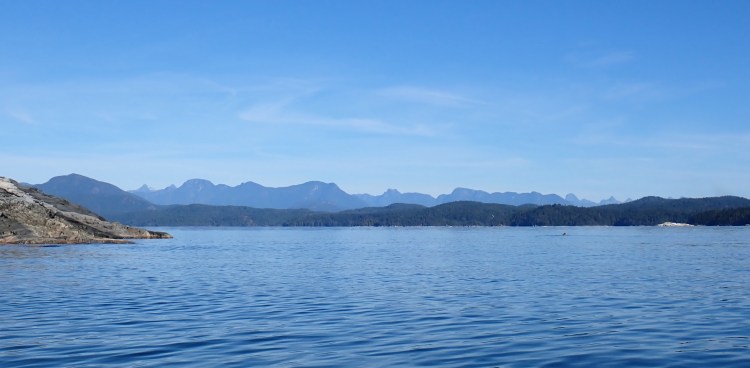
View of Coast Mountains opening up as I round the south end of Read Island, with Cortes Island at right. 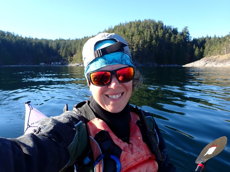
Happy paddler on a sunny, calm day. 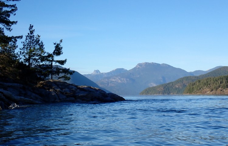
Frederic Point, close to my camp site, with the Penn Islands and the Coast Mountains in the background. 
Campsite at Whale Passage, looking back towards Read Island and Quadra Island. 
Evening light at Whale Passage — and some current ebbing south. 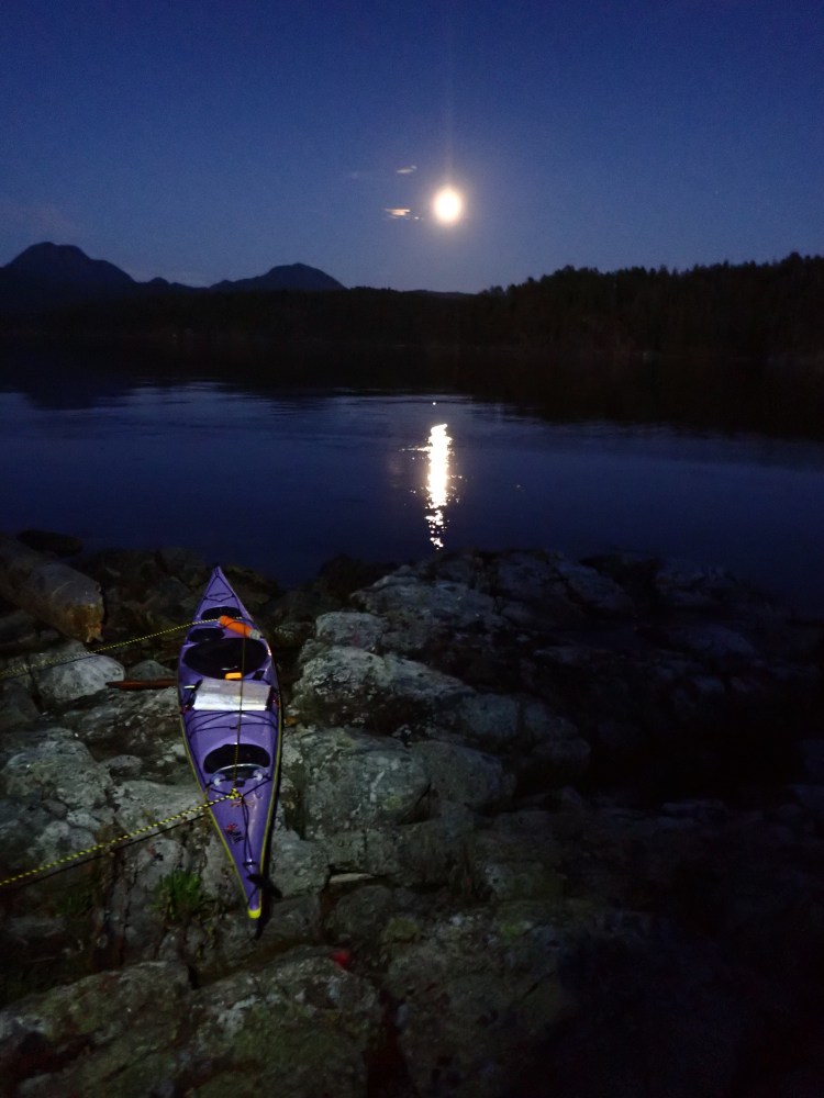
Full moon night. 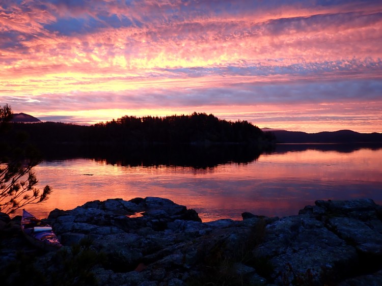
Sunrise over Whale Passage. 
Exploring the nooks and crannies of Evans Bay. 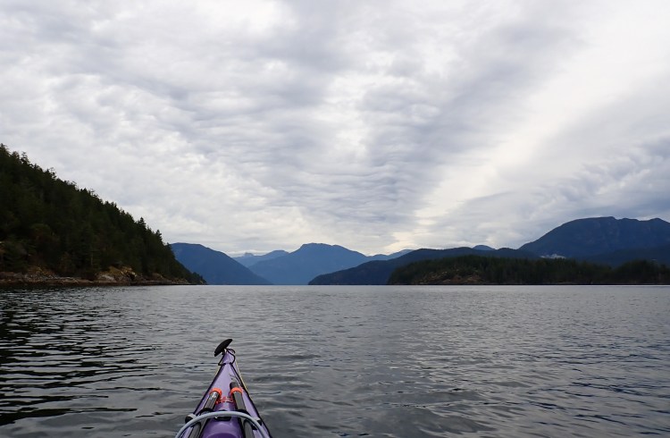
The view opens up as I round Frederic Point to head north. 
The hump of Raza Island ahead, with the Coast Mountains behind and the tip of Cortes Island at right. 
This view never gets old. 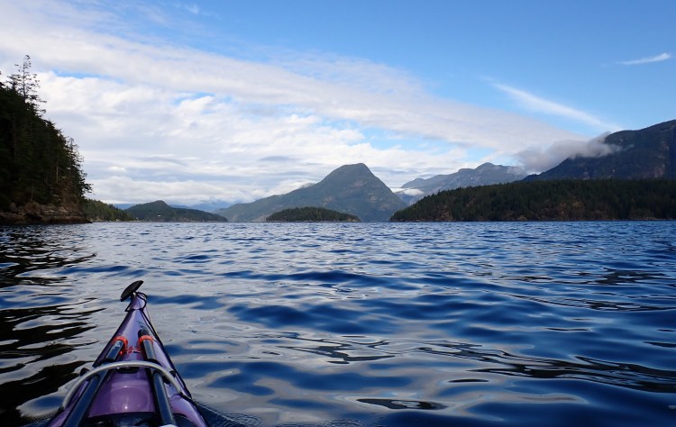
Rendezvous Islands strung out in Sutil Channel, with mountains of the Downie Range behind.
Still to go…
Southern Gulf Islands
- Galiano Island
- Mayne Island
- Moresby Island
- Pender Islands
- Penelakut Island
- Prevost Island
- Salt Spring Island
- Saturna Island
- Sidney Island
Northern Gulf Islands
- Ahgykson Island (formerly Harwood Island)
- Denman Island
- Hornby Island
- Jedediah Island
- Lasqueti Island
- Texada Island
- Thormanby Islands
Discovery Islands
- Cortes Island
- Hardwicke Island
- Hernando Island
- Mink Island
- Mitlenatch Island
- Quadra Island
- Raza Island
- East Redonda Island
- West Redonda Island
- Rendezvous Islands
- Savary Island
- Sonora Island
- Stuart Island
- East Thurlow Island
- West Thurlow Island
- Twin Islands
